YOUTUBE SERIES · AGGREGATE INTELLECT
Drone Image Classification of Urban Green Spaces
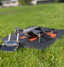
High-resolution drone images provide detailed snapshots of a city’s landscape. In this Aggregate Intellect working group, we examined multiple ML techniques trained on custom-collected data to detect, count, and classify urban trees — then package the workflow so city staff can actually use it.
Python is required. Familiarity with Google Colab, TensorFlow, and NumPy helps for the modelling tasks. No prior remote-sensing background is needed.
What you learn
- Access, download, and align remote-sensing imagery from public parks
- Organize and structure large datasets for custom / computer-vision ML projects
- Build a custom vision model with open-source tools (e.g. YOLOv4 / YOLOv5)
- Object detection: count trees in a given image
- Classification: group trees (e.g. deciduous vs conifer)
- Demo a classifier quickly via a webapp (e.g. Flask API)
- Test robustness across seen/unseen Canadian regions and tune hyperparameters
- Compare against cloud tools such as CustomVision.ai
- Optimize with TFLite / Yolov4-tiny for phone, web, or edge deployment
Resources